Research Initiatives
Email us: consultant@seisxploregeosurvey.com or phone/WA: +62 821 7211 1561
Cavity Identification Using Georadar Method on River Embankments
July 4, 2024
The construction of embankments in river areas is often faced with relatively difficult embankment constraints due to the existence of weak zones. This is because the sedimentation area is deep and never settles (or moves).
The process of embankment with soil material will usually experience periodic subsidence because there is a groove area that is softer than the surrounding embankment. Subsidence will continue in this groove area for the next few years.
This subsidence area becomes a weak area, and its dimensions will be clearly visible with detailed dimensional coverage. The GEORADAR method will cover the dimensions of the weak area or cavity around 0.5m. Especially in the implementation at the bottom, the embankment is carried out with aggregate material, rocks, or concrete with dimensions so that there are gaps between the materials.


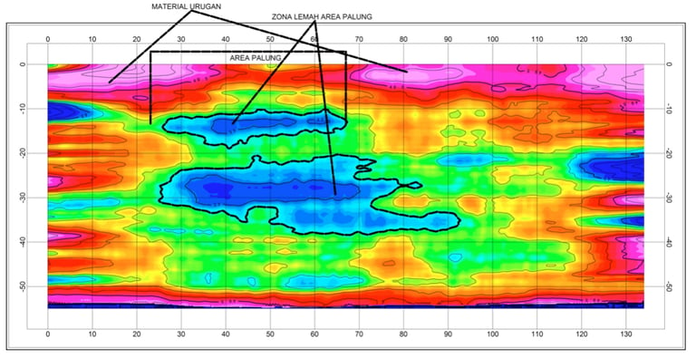
The image above illustrates the upstream embankment area with layer characters in different hardness values. The red is soil with high NSPT values while green to blue is the lower NSPT value. The blue colour represents the weak zone area which is an area of soft sediment or water flow and has a high water content.


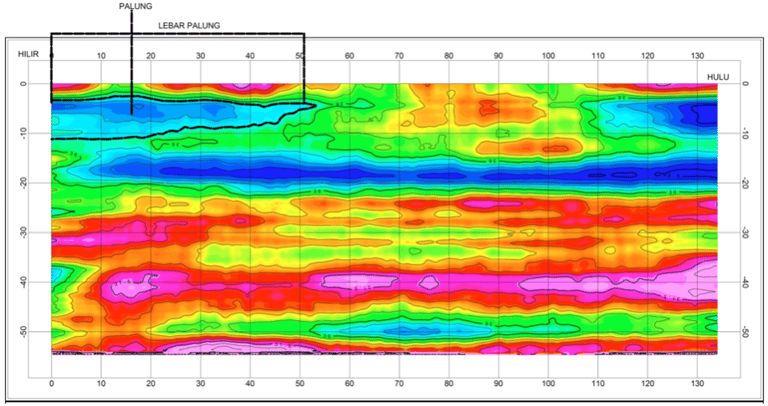
The image above shows that in the middle of the embankment, the red colour is hard soil which is the selected embankment soil and the green colour is soil with embankments that have high water content and low NSPT values, while the blue colour is the area where water flow is still flowing with an NSPT value of <5.
Figure 1. The weak zones (subsidence areas) indicated by the blue colour areas in the middle.
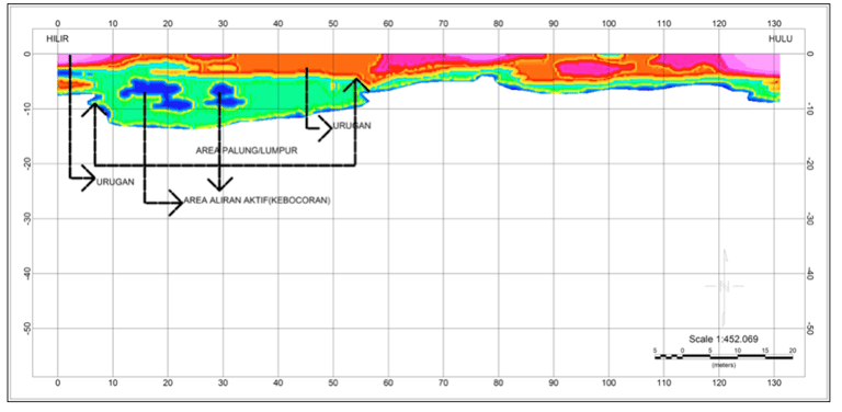
Figure 2. The blue colour zones marked by the black lines are the areas with water flow.
