Lower Frequency GPR
The application of low-frequency Ground Penetrating Radar in Geology and Geotechnical
Low frequency is used for deeper targets. Example of Low Frequency for (10-80MHz) Depth 15-120m:
- Identification of soil layers (stratigraphy/lithology), slip planes, high water content, weak zones, and paleochannels.
- Examining soil properties (Geotechnical), and seepage and dam leakage investigation
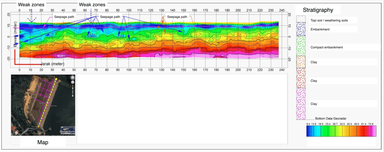

Figure 1. Stratigraphy, weak zones and seepage zones identification at Nongsa Dam.
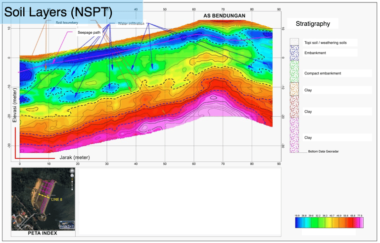

Figure 2. Soil layers interpretation at Nongsa Dam based on NSPT values.
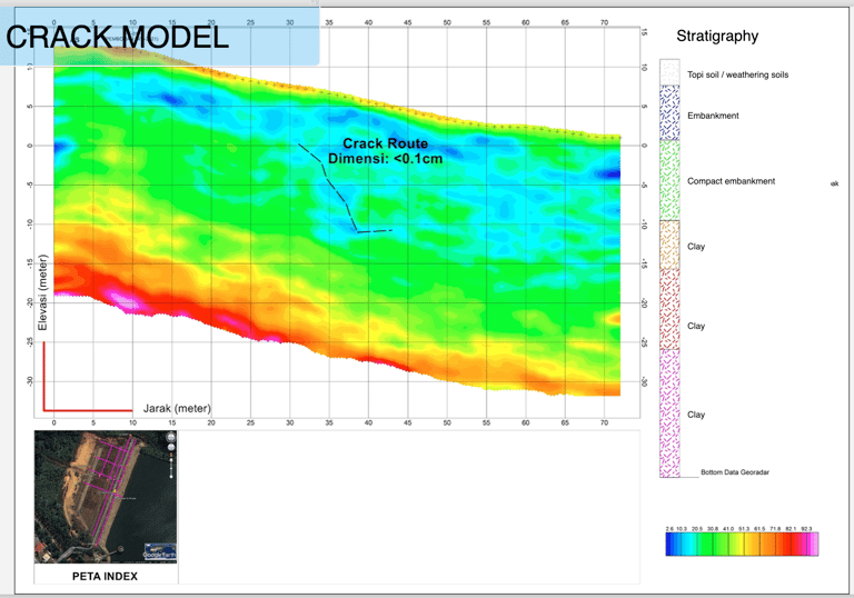

Figure 3. Crack Model Analysis at Nongsa Dam
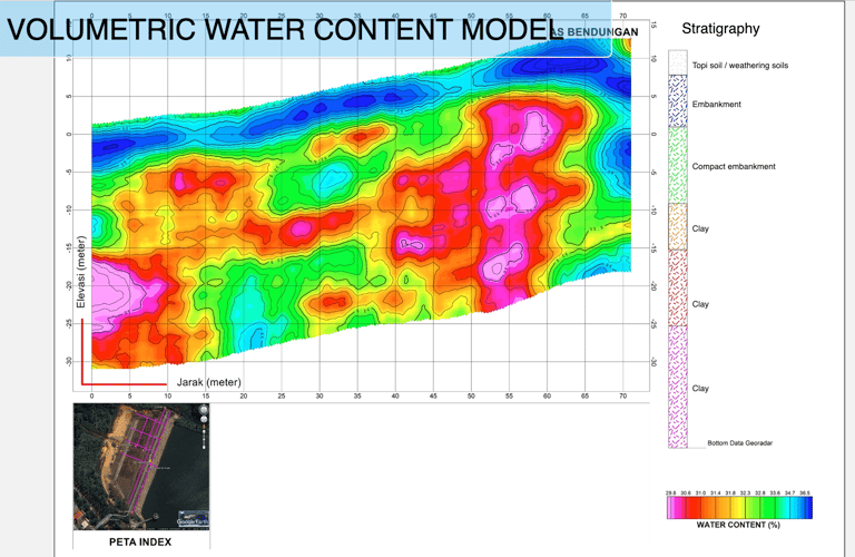

Figure 4. Modelling of Water Content at Nongsa Dam.
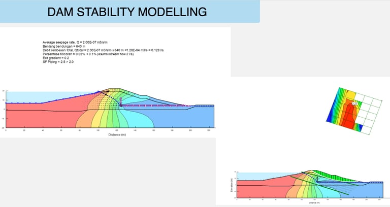

Figure 5. Dam Stability Analysis including seepage rate calculation, seepage debit and leakage percentage.
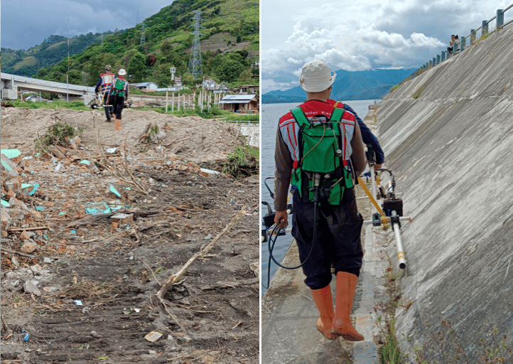

Georadar survey on the embankment Tano Ponggol at Toba Lake was conducted using lower-frequency GPR to determine the stratigraphy of the area and the paleochannel.
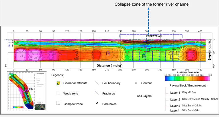

Figure 1. Investigation of collapse areas at Tano Ponggol Embankment.
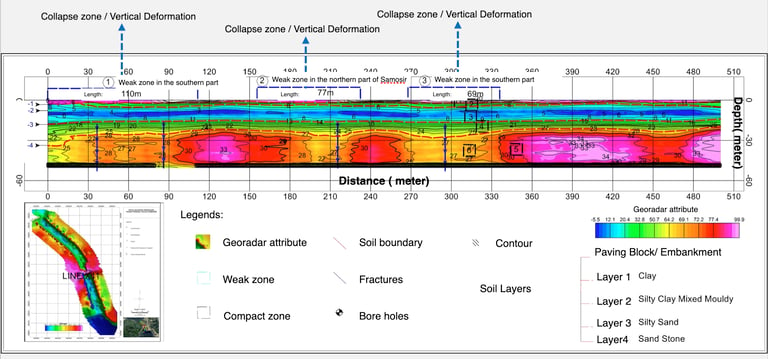

Georadar Survey for Stratigraphy Analysis and Landslide Investigation at Dam and Irrigation Rengrang
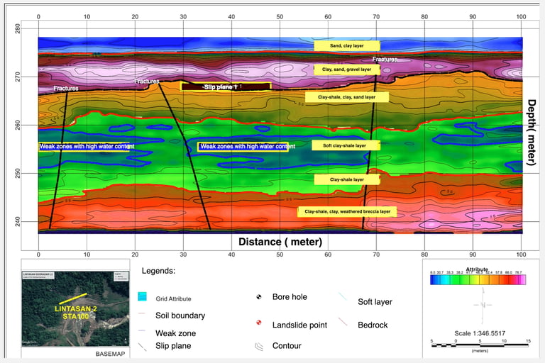

Figure 1. Subsurface interpretation including weak zones, fractures, slip planes identification.
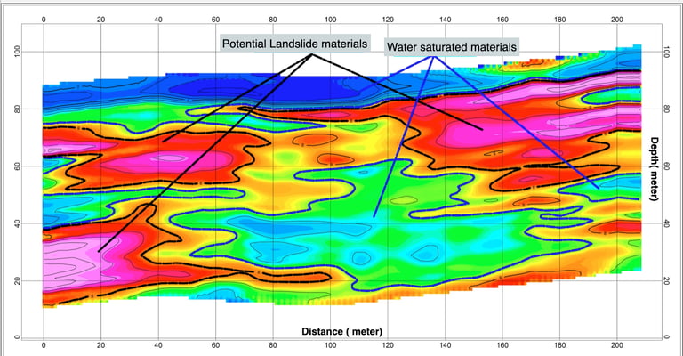

Figure 2. Potential landslide analysis.
