Ground Penetrating Radar for Mining and Geotechnical Support
Georadar Survey for Nickel Laterite Exploration
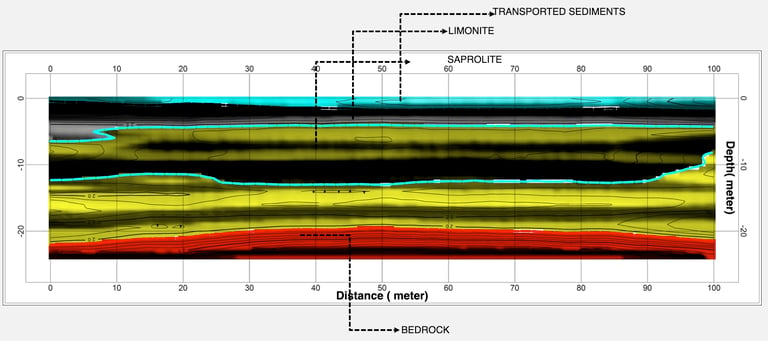

Figure 1. Subsurface interpretation indicating limonite and saprolite layers. These two minerals are important for nickel exploration as they are both components of nickel laterite ore and are a primary source of nickel.


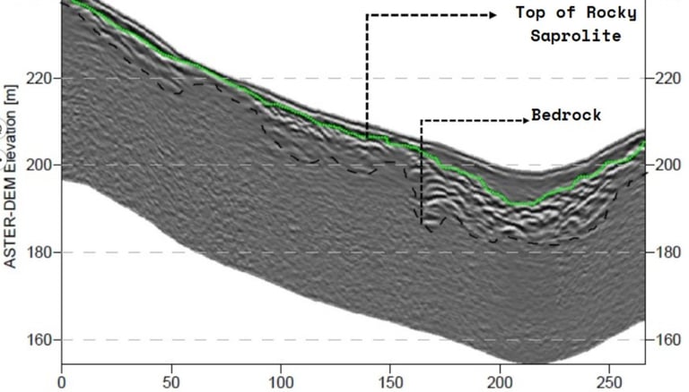

Figure 2. Saprolite and bedrock layers.
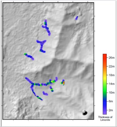

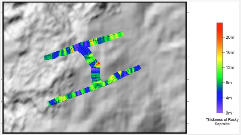

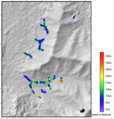

Figure 3. Thickness estimation for each layer.
Georadar Survey for Stratigraphy and Coal Dumping Pit
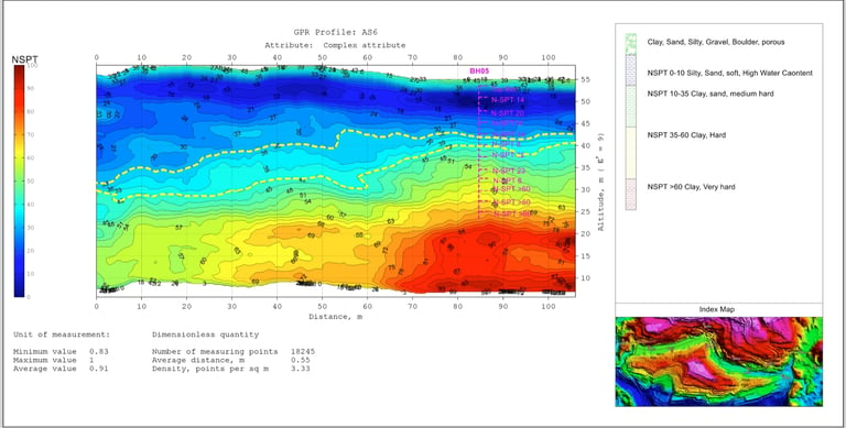

Figure 1. NSPT data analysis and validation with drilling data. The first yellow dashed line indicates the bottom soft soil (clay-sand) followed by medium clay and hard clay at the bottom line.
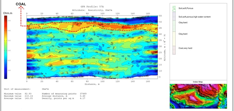

Figure 2. Coal layer is indicated by the red dashed line.
